Monday, November 4, 2013

NGEE Arctic Goes to School…

Oak Ridge National Laboratory (ORNL) held their annual Fall Festival on Friday, November 1, complete with live music, food, and various arts and craft displays. The laboratory used this event to also unveil two science education trailers – one from the Neutron Sciences Directorate and the other from the Energy and Environmental Sciences Directorate (EESD). Both trailers were designed to take cutting-edge science from the laboratory to elementary, middle, and high school students. The Fall Festival provided a great opportunity to showcase the trailers and their scientific displays to ORNL staff before taking them on the road.


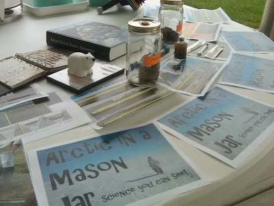
Since Kathy Huczko, technical project manager for NGEE Arctic was a member of the team that designed the EESD trailer, we volunteered to set-up a display that would provide an opportunity for students of all ages to gain first-hand experience with frozen soils or permafrost from the north of the Arctic Circle. The “Arctic in a Mason Jar” display was specifically developed with the idea that students would learn where the Arctic was located (i.e., a long ways from where they live), how field scientists obtain permafrost cores, and how laboratory researchers measure greenhouse gases (e.g., carbon dioxide and methane) that are produced from thawing permafrost. I was fortunate to have Taniya Roy-Chowdhury help put this display together and then have her talk people through the various aspects of the display. Taniya participated with our team last April in coring samples from the Barrow Environmental Observatory (BEO), outside Barrow, Alaska. She is also doing the laboratory research as part of her post-doctoral studies at ORNL so Taniya had no trouble conveying the underlying science to people in way they could easily understand. Feedback was positive and we had a great time showing everyone this unique aspect of the project.


Taniya and I will take our experience with ORNL staff and continue to modify the display to best interest students in topics that are relevant to Arctic ecosystems. Taniya and I agreed that we want to make science fun and informative for everyone regardless of age. Based on our experience at the Fall Festival, we took a positive step in that direction.


Monday, October 28, 2013

LANL September 2013 Synoptic Sampling a Success!

Despite the cold (and overly ambitious) days of fieldwork in Barrow, the consensus among LANL’s hydrology and geochemistry research team is that our 2nd Synoptic Sampling Campaign in September 2013 was a huge success! Our field crew consisted of a highly motivated and hard-working team from LANL including: Lily Cohen (post-bac, and research superwoman); Garrett Altmann (post-masters, and GIS/remote sensing guru); Marvin Gard (staff, and world class innovator/inventor); and Heather Throckmorton (postdoctoral researcher, and isotope geochemist and enthusiast).

The goal of our research is to assess isotopic and geochemical tracers to infer hydrologic processes, and vertical and lateral movement of carbon across the broader landscape. Our most recent sampling campaign in September 2013 has been an extension of a previous campaign in July 2013, during which we established 17 sites across the broader landscape (both inside and outside the BEO) to collect water samples for analyses. Our sites were initially selected by looking at satellite images of the BEO and surrounding region to identify main drainage channels and outlets from different aged drained thaw lake basins (DTLBs), as locations that integrate hydrologic signals over larger areas. (see below map)
 

This September we revisited the same 17 site-locations as in July (please refer to map) in order to identify seasonal changes/variability, with the thawing of frozen soils throughout the summer, and corresponding deepening of the frost table.

During our most recent trip this September, we noticed several clues supporting seasonal differences in hydrology relative to July conditions. Our first clue, as expected, was the significant deepening of the active layer as we measured the depth to the frost table at all of our sites. This presumably has significant implications for subsurface hydrologic flow, as deeper mineral rich soil horizons become hydraulically conductive.

Seasonal melt correlating hydrologic processes with geomorphologic features was also really exemplified by a dramatic thermokarst feature that we encountered on our walk in to our site 11 (see map). We previously observed this feature in July as well, but the advanced thawing/melt over the season has promoted slumping on the ridge, and resulted in the interesting feature below.
 
Additionally, although surface waters can often appear stagnant in the BEO and surrounding region, at a couple of our sites in July we had observed very gentle lateral surface flow and drainage. During our recent trip in September, we noticed visibly greater lateral surface (and subsurface) flow at several of our sites relative to what we observed earlier in the season.

Another notable difference we observed from July to September was an increase in lateral extension of surface water in ponds and drainages at several of our sites. In the vast and hummocky tundra landscape, lateral expansion of surface water would typically be difficult to notice from visible inspection only, with such few distinct reference points in the landscape. However, when we sampled in July, we stationed along the edges of ponded or draining surface waters, marking these locations with bamboo for our return trip in September. During our recent September trip, upon revisiting these locations, we estimated that in many cases the water extended a few meters farther than in July (laterally); and in one larger drainage channel (site 8 on attached map), we estimated lateral expansion of at least 25 meters.

In addition to seasonal variation in hydrology (and significantly colder weather in September!), we’ve noticed some very exciting spatial variation across the broader landscape highlighted by differences in a variety of features across our sites, including: lateral surface hydrologic flow rates; hydrologic conductivity (i.e., the rate we can extract water); depth to frost table; soil properties; and basic field parameter measurements relating to groundwater redox and geochemistry.

In particular, we were excited and encouraged by the outcome of Iron Reduction in Sediment (IRIS) probes that we installed in July, as an indicator of below-ground oxidation–reduction conditions. Dissolution of the ferrihydrite coat on probes showed interesting patterns that varied across sites, which we will quantify with image analyses to better understand redox microsites and variation across the broader landscape (photo below on left). At some locations, IRIS probes developed black speckles of iron sulfide, providing additional insight into below ground biogeochemistry (photo below on right). To our knowledge, this is the first time this technology has been deployed in this type of environment, and we feel that IRIS probes seem promising for improving our understanding of spatial and temporal variation in redox across a range of scales.
 
 
We are looking forward to pursuing analyses on water and soil samples back at LANL to better understand how spatial and seasonal variations in hydrology may correspond to and influence biogeochemical processes and C transport. For example, do we see different sources of water spatially and seasonally? Different sources of carbon across the landscape, as organic rich soils thaw throughout the summer and leach or become transported? How do these different hydrologic conditions affect biogeochemistry and redox? Microbial processes? C transport? These are only a few of the questions we are excited to address. So far so good-as our research group, as well as soil and water samples, have all made it back to LANL intact!


Wednesday, July 24, 2013

LANL Synoptic Survey Team July 8th-17th, 2013

The LANL team (Jeff Heikoop, Heather Throckmorton, Garrett Altmann, Lily Cohen and Michael Hudak) continues its synoptic survey of water isotopes and chemistry to understand hydrologic pathways and transport in the BEO and surroundings.  This year, our focus has shifted from the polygon scale to larger drainage systems with particular emphasis on outlets from interlake areas and different aged drain thaw lake basins.  We are taking samples from surface water, the uppermost part of the active layer (0-4” from surface), and the active layer at the frost table (~11-16”) at 15 locations.  Sampling at the frost table has proven particularly difficult so we have employed arrays of rhizons to obtain sufficient water while minimizing disturbance (rhizons make a hole only about a finger’s width wide and can be removed immediately after sampling) (Photo 1).  The team also got to try out a system for filtering water samples through syringe filters (as small as 0.2 microns) aided by an electric caulking gun.  This has saved us hours of tedious and tiresome effort.  Our thanks to Marvin Gard whose ingenuity continues to amaze us!

The team is also testing Iron Reduction in Sediment (IRIS) probes to see if these might be a simple and cost-effective way to monitor redox changes on the broader landscape when collection of subsurface water samples may not be practical.  These probes consist of PVC coated with a ferrihydrite paint (photo 2).  Under reducing conditions iron on these probes will partially dissolve.  The amount of dissolution can be quantified by image analysis and related in a semi-quantitative fashion to redox conditions in the sediment.  IRIS probes have been approved by the EPA for demonstrating the presence of reducing soils for wetlands delineation. We are deploying these probes adjacent to our rhizon arrays so that we can compare out chemical results (a snapshot in time) to the time integrated signals provided by the IRIS probes, which will be pulled in September.  Image analysis will employ LANL’s GENIE technology.

In addition to synoptic survey activities, Liz Miller of LANL has also joined the team to perform a high-resolution differential GPS survey of troughs and flooded low-centered polygons to fill in gaps in LIDAR data.  This data will provide sub-centimeter elevation profiles for improved hydrologic modeling of the site (photo 3).

After rigorous days in the field, field team leader Heikoop was particularly impressed that his younger colleagues decided rooms in the Herman House should be segregated based on age with no doubt as to which room he belonged.  He also wants to thank Cathy Wilson for arranging to have high caliber athletes, including a champion ironwoman and world-class skier on the trip for him to keep pace with.  Fortunately everyone has provided plenty of calorie replenishment back home at ‘camp’ with their array of culinary talents. 

Photo 1: Rhizon array in ancient DTLB.

Photo 2: Mike Hudak holding IRIS probes prior to deployment in a young DTLB to the south of the BEO.

Photo 3: Liz Miller performing high-resolution GPS surveying.


Friday, July 19, 2013

Pic of the trip...


The NGEE Arctic team takes a lot of pictures during their stay in Barrow. Most relate to their science, but a few simply reflect the unique nature of life on the North Slope of Alaska. While I certainly do not see all pictures taken by people when in Barrow, I do see enough to post my favorite ones from this past trip.

The first "pic of the trip" was taken by Lily Cohen. Lily is from LANL and snapped this picture of jelly fish one evening as she walked along the Arctic Ocean just a short distance from our Herman House apartment.


The second "pic of the trip" was taken by Garrett Altmann. Garrett is also from LANL and took this mushroom picture one afternoon while collecting water samples from a drained thaw lake basin south of Barrow.


My thanks to Lily and Garrett for capturing these great images of the Arctic.


NASA program staff come to Barrow...


This past week was a productive one for our NGEE Arctic team in Barrow. July is a busy month for us with more than 20 scientists, staff, and students working at our field sites on the Barrow Environmental Observatory (BEO) and to the south across a series of drained thaw lake basins. The weather was good early in the week, but it turned foggy with a light rain especially in the last few days. As the winds died down and air temperatures rose, the mosquitoes came out with a vengeance. Deet and bug jackets were definitely required if you were going to make working in the field bearable.

Although the weather could have been better, this was the week that several NASA program office staff would visit Barrow. I picked up Peter, Dan, Libby, and Leanne, as well as University of Maryland professor Eric Kasischke from the airport on Monday morning. They had traveled to Barrow in order to familiarize themselves with tundra ecosystems of the North Slope of Alaska. They also wanted to see first hand the many scientific facilities in town and to visit with UMIAQ, the logistical provider who supports our NGEE Arctic project.

We spent two days touring the Department of Energy, Atmospheric Radiation Measurement (ARM) climate research facility; the NOAA CMDL facility; the Barrow Arctic Research Center; and the BEO where we and others have field research sites. This gave Peter, Eric, and others a good overview of the long-term monitoring activities in Barrow and the types of science being conducted at these facilities and the BEO. My thanks to everyone who helped make our discussions productive, especially Karl, Eric, Jon, Brower, Laci, Araina, and Uinniq, all from UMIAQ. And my thanks to Walter and Marty for tours of the ARM and NOAA facilities, respectively. Despite the hordes of mosquitoes, it was a good visit...one that was both enjoyable and met the goals of the trip.


Tuesday, July 16, 2013

Flying kites on the tundra


Scientists can be creative! A perfect example of this creativity reveals itself when the NGEE Arctic project needs to collect aerial images of ice-rich polygons on the Barrow Environmental Observatory. We could rely on high-resolution pictures from aircraft, but given the small area of our intensive site that would be expensive. Unfortunately, the resolution of satellite imagery is too coarse. Why not just hang a camera from a kite? We saw this used quite effectively last year by Craig Tweedie and his students from UTEP, so we thought we'd give it a try!  That's what Baptiste Dafflon and Craig Ulrich (both from LBNL) did yesterday after testing the concept several weeks ago in California.


Baptiste and Craig have conducted geophysical surveys on the BEO now for two years. The goal has been not only to understand sub-surface properties like ice content and size and distribution of ice wedges, but also to relate those characteristics to surface properties including topography and the fraction of the landscape seasonally inundated by water. The team needed, however, some way to correlate patterns of inundation to variation in sub-surface properties. The kite seemed like a worthwhile approach to try. It is too early to comment on the overall utility of the idea, but an initial look at the aerial images suggests that the quality of pictures makes this kite-based approach a reasonable one for our purposes.


Baptiste and Craig, along with others on the NGEE Arctic team, plan to replace the camera with a spectrometer in hopes of using spectral signatures to identify water distribution and landscape patterns of inundation throughout the season. Then it will be possible to begin drawing correlations between surface and subsurface characteristics and using those insights to improve multi-scale models of terrestrial ecosystems.

Monday, July 15, 2013

Time for tacos...

It seems like my LANL colleagues have instituted a new tradition when in Barrow - Sunday is apparently taco night! Just exactly how this started is uncertain, but Garrett Altmann and others staying in the Herman House apartment, opened their doors to all participants in the NGEE Arctic project for dinner. Garrett and Heather had gone to the store earlier in the day and bought all the necessities for a Santa Fe style mexican dinner. Garrett took over the kitchen with others helping prepare soft and hard shell tacos complete with a spicy meat sauce, tomatoes, lettuce, and avocados. Team NGEE Arctic has a chef that prepares a pretty awesome menu...


Dinner attracted nearly 20 hungry scientists, staff, and students from all 4 of the national laboratories and several of our university partners. The food was great and there was a lot of discussion as people got to know each other. I heard a lot of comments like "What do you do?" and "Oh, I sent you an email...". It was a fun night that continued until midnight. Then someone said "Hey, field work starts at 8:00am!" and there was a realization that everyone better get some sleep!


It was a fun night. Herman House has a 'no shoe' policy so my favorite scene of the night was our front entry way. Shoes were everywhere and a good time was had by all.
 

Night...

Chambers used to estimate CO2 and CH4 flux

One of the primary goals of the NGEE Arctic project is to characterize carbon cycle feedbacks between tundra ecosystems and climate. We have larger, more holistic goals as well, but this is a major component of our studies. Therefore, we have made a considerable effort to emphasize measurements of CO2 and CH4 flux to and from soils and vegetation. This includes deployment of an eddy covariance system on the Barrow Environmental Observatory (BEO) to characterize carbon fluxes at landscape scales. Dave, Naama, and Margaret are handling those aspects of the project. Dave is from the University of Nebraska and is one of our collaborators; Margaret and Naama are from LBNL. We also took soil cores in the field last spring that we are studying now in the laboratory under controlled conditions. David and Taniya at ORNL are conducting those studies. I look forward to seeing data from these large and small scale investigations.

In addition to our eddy covariance and permafrost core measurements of carbon fluxes, our NGEE Arctic team has also deployed several different manual and automated chambers in the field for estimating CO2 and CH4 fluxes. Evidence for these intermediate-scale approaches can be seen scattered about the tundra. Melanie has placed white PVC collars in our permanent plots and within the eddy covariance footprint. A chamber can be manually attached to these collars and measurements of CO2 and CH4 flux made throughout the summer.


Lydia and Bryan, both from LBNL, have deployed similar chambers in our various plots both along our transects and in our intensive plots that encompass low-, transitional-, and high-centered polygons. These chambers can be monitored for carbon fluxes, but they are also being used to collect gas samples for 14C analysis. This is done by connecting small evacuated cylinders to chambers sealed to the soil surface again via collars. Gas samples can then be analyzed for 14C and determinations made as to the age of carbon being emitted from thawing permafrost. These measurements will be critical in combination to some of our other process measurements as we better represent carbon cycle dynamics in models.


The chambers that Lydia and Bryan have deployed are convenient for measuring CO2 and CH4 fluxes across that landscape, but tend to be limited to weekly campaigns. It is difficult with those kind of chambers to get temporally-resolved estimates of flux at, for example, hourly intervals throughout the day. We overcome that limitation by using automated chambers. These require a source of power, but can collect information on soil respiration or ecosystem gas exchange, depending on the exact type of chamber, throughout the day, week, or season. Melanie from the University of California, Berkeley has deployed one of these chambers near our eddy covariance tower.


Together with our other measurements like soil temperature, moisture, redox, etc., these chambers should be helpful as we seek to improve representation of carbon cycle processes in climate models. Given enough data, we can more fully understand what controls rates of CO2 and CH4 flux for Arctic ecosystems. In order to do that, we must bring together supporting data from genomics, hydrology, biogeochemistry, vegetation dynamics, and subsurface science. We have a good team for tackling this objective.


Tuesday, July 9, 2013

NGEE Arctic enjoys a little publicity

Before leaving for the airport this morning I stopped by the office of the ORNL Laboratory Director, Thom Mason. I don't make a habit of this, but it did, among other things, give me the opportunity to quickly brief him on the NGEE Arctic project.

As I walked into his office, I picked up what I thought was a new glossy brochure highlighting science and technology at ORNL. I was pleased to see that one of those highlights was of our work in the Arctic. The picture that accompanied the article shows Victoria harvesting above-ground plant biomass from one of her vegetation plots last year at our field research site on the Barrow Environmental Observatory (BEO). Victoria is a post-doc working with Rich, Colleen, and others on the vegetation dynamics tasks and has a keen interest in plant community composition and processes like root growth and distribution of biomass throughout the soil profile.


I sent the picture to Victoria who is in Barrow again this summer. A quick response indicated that while Victoria was pleased to enjoy her 15 minutes of fame, she didn't know that it would come in the form of a picture showing her sitting on the tundra, wearing a bug jacket, and holding a pair of scissors. I had to laugh. Getting a career started in global change biology is a tricky business, and I agree that field work can at times lack the glamor of other scientific disciplines! However, I suspect that Victoria will have the opportunity to enjoy many more minutes of fame because of her hard work and attention to detail, I'm glad that she is part of the project.

So, what about my NGEE Arctic briefing of Thom Mason? It went well. He has a great understanding of all the work going on across the laboratory. Climate modeling and the importance of field and laboratory measurements that serve to support those models is an area familiar to him. He even had comments about the NGEE Arctic blog. Having thought about it for a few hours now, maybe Thom would enjoy going to Alaska like Martin Keller, Associate Laboratory Director, and others did last year? That was a great trip! Let's see, we could...

Monday, July 8, 2013

Heading back to Alaska – Activities for the coming days

Having just recovered from my trip to Toolik Lake, Barrow and the Seward Peninsula two weeks ago, I am stepping back on an airplane bound this time for Fairbanks and then onward to Barrow.  My objectives for this trip are two-fold.  First, I will be taking part in discussions related to the NASA-sponsored ABoVE or Arctic and Boreal Vulnerability Experiment (http://above.nasa.gov/).  The Science Definition Team (SDT) is composed of 20 or more scientists who are working together to develop a concise science plan for this activity. As many of us know, climate change in the Arctic and Boreal region is unfolding faster than anywhere else on Earth, resulting in reduced Arctic sea ice, thawing of permafrost soils, decomposition of long-frozen organic matter, widespread changes to lakes, rivers, coastlines, and alterations of ecosystem structure and function. In tackling this multi-disciplinary challenge, NASA’s Terrestrial Ecology Program (led by Diane Wickland) is in the process of planning a major field campaign which will take place in Alaska and western Canada during the next 5 to 8 years. ABoVE seeks a better understanding of the vulnerability and resilience of ecosystems and society to this changing environment.

Although the full scope of the ABoVE project as yet to be defined, research carried out as part of ABoVE will integrate geospatial data collected by airborne and satellite platforms with information obtained from field studies and ground-based monitoring across high-latitude ecosystems. Dan Hayes (Oak Ridge National Laboratory) and Eric Kasischke (University of Maryland) has the distinction of serving as the two co-Chairs for the ABoVE SDT. It is envisioned that through a series of conference calls and face-to-face meetings the SDT will, over the next 12 months, refine the science questions and issues to be addressed in ABoVE and then develop a detailed study design for the ABoVE field campaign. The work of the SDT will culminate in a concise experiment plan that NASA will use to guide its implementation of the field campaign. This plan will include the science questions to be addressed; a compelling rationale explaining the scientific and societal importance of the study; the research approach/strategy; and a reasonably detailed study design and description of required field and remote sensing observations, required field infrastructure, logistics, and data management capabilities.  The SDT has already met once and is well-prepared for their second meeting in Fairbanks.

A group photograph of the NASA ABoVE Science Definition Team (SDT) at a recent meeting in La Jolla, California.
In addition to contributing to the ABoVE SDT discussions, I will also be traveling to Barrow where I will (1) conduct field work as part of the NGEE Arctic project and (2) host five NASA program staff as they continue to learn more about the Arctic and how they might leverage established field sites in Alaska and western Canada. Prior to their arrival in Barrow, these five will have visited Toolik Lake.  I look forward to hearing about their experiences and comparing notes since I was there just a couple of weeks ago.  We have a great schedule of activities planned for NASA staff in Barrow with tours of the DOE-sponsored Atmospheric Radiation Measurement (ARM) Facility, the Barrow Environmental Observatory (BEO) and the NGEE Arctic field sites.  I will be posting updates on that portion of our trip beginning Monday, July 15.


Science Camp – A job well done


Alessio and Skye have now completed the last day of science camp in Barrow. It ended on a positive note. All the kids completed a poster in which they summarized what they had learned during the week. Alessio writes that “Yesterday night we were a little worried about this final day. Were we asking too much? Will the kids be understandably tired of working after 6 days?” Not surprisingly, some of them needed a lot of encouragement to get their posters completed, a project that required anywhere from 2 to 3 hours of solid work, with little distraction. Alessio admits what they did not want to do was end the camp with kids struggling to get their posters done. With a lot of determination, the kids took the bull by the horns and did their very best to produce nice posters which were then proudly displayed for their peers.

 
Thus, with modest fanfare the Earth Science camp came to an end. It was quite an adventure for Alessio. This journey began in January, with the drafting of an initial proposal, continued with the planning of all the activities and ended up in Barrow, in the great Arctic summer, surrounded by the joyous laughs of 10 kids. Alessio mentioned that he “did not know why he and Skye ended up doing this camp. On many occasions, while studying in Fairbanks, he heard about the “other Alaska”, the rural Alaska, the Alaska that goes forward in remote places, in small native communities.” Apparently curiosity did get the best of him and the science camp became a reality. And what better than a summer camp with rural youths to learn something about this world?  

And, according to Alessio, something indeed was learned. “First, we now have our Eskimo names: my name is Ukpik, it means snowy-owl and Skye’s name is Ugruk, bearded seal. Second, I have come to realize that middle school students are an immense source of fun. You can spark their excitement with pretty much everything. It is, however, a very short, intense fire, as they tend to get bored pretty quick. Never drop the guard or you will lose them. Third, offering opportunities to youths is an incredibly noble and rewarding act. Ilisagvik offers camps for middle and high-school kids throughout the entire summer. Earth Science, Land resource, Photo-journalism, Inupiat values, construction camp and so forth. It is essential to inspire youths. Fourth, our best lesson all week; Tunnel Man was awesome!” Alessio admits that the kids grew a little tired of his attempts to explain permafrost. However, with the help of Tunnel Man, all of a sudden the interest level of the kids increased a notch. What was a boring message imparted so succinctly by their teacher with a strange Italian accent, became a mysterious Alaskan superhero, a dude that mushes across frozen rivers, visits their villages, traverses the Arctic, and raps about permafrost.” Alessio spotted a few of the kids independently watching Tunnel Man on their IPhone after class. He speculates that if we want to communicate climate change and educate the next generation on Arctic science, perhaps we need to elicit the assistance of Sea Ice Woman, Ecosystem Crusader, Glacier Dude, and the Snow Drifter.

Finally, Alessio closes by saying that his “…personal map of Alaska has now been enriched by Point Lay, Point Hope, Wainwright, and White Mountain. I did not actually go to these places, but I have the smiles of their kids well fixed in my memory.”  Alessio concludes by thanking Illisagvik College, Exxon Mobile, Conoco Phillips, the Alaska Climate Science Center, and the International Arctic Research Center (IARC), University of Alaska Fairbanks for sponsoring this science camp.


Friday, July 5, 2013

Terrestrial vegetation takes center stage at science camp - Day 4


Alessio continues to demonstrate a great ability to engage others in the science camp activities. A few days ago he enlisted the assistance of Liyuan and Beth, and that was a success. Today he was able to coordinate with two other NGEE Arctic investigators – Victoria and Jenny – to talk with the kids about plants. These two plant ecologists have spent several years working in the Arctic, especially in Barrow, and they know their plant communities extremely well. Victoria writes “This afternoon we printed off copies of the Alaska vegetation map and distributed those to the kids. We then asked them to introduce themselves by saying their name, age, where they lived, and their vegetation type. The kids had a fun time trying to decide if they were moist acidic tundra or a tall shrub.” Victoria mentioned that “one boy was from a location much further south than the others and wasn't on the map, so our discussion was briefly diverted to the difference between tundra and boreal forests and why there are no trees in the Barrow area.”


Victoria and Jenny picked a great topic since Alessio and Skye had the kids collect and draw plants earlier in the day. Given that activity, each child had a question for Victoria and Jenny - some easier than others. There were very good ones relating to fungi and shrubs, the nutritional content of lichens, and plant reproduction. Victoria wrote that “the kids really liked the description of tillering in sedges - the 'mothers' and 'daughters', and the idea of huge patches of vegetation being one large family of tillers.” Earlier in the week our NGEE Arctic team had seen evidence for this just south of the Barrow Environmental Observatory (BEO) in a series of drained thaw lake basins and Victoria and Jenny were able to use this experience to reinforce their botany lesson.

After discussions of plant communities, Jenny showed off the ASD spectrometer and together she and Victoria explained that the vegetation map was derived using a satellite that collected similar types of data. This led to a broad range of questions about light, wavelengths, and spectra; and to all sorts of related topics, including how insects see different patterns on flowers (in the UV) and some basic philosophy about whether wavelengths outside the visible spectrum can legitimately be described as 'undiscovered colors'.


Victoria and Jenny then shared with the kids a copy of the Flora of Alaska and explained about Eric Hulten and the detailed work he did to compile his vegetation surveys. Hulten was a Swedish botanist, plant geographer, and 20th century explorer of the Arctic. Jenny apparently had just read his biography and suggested that the kids keep an eye open for the poppy named after him as they drive around Barrow - Papaver Hultenii. 


Allessio writes that the topic of plants sparked an excellent conversation. The kids were very enthusiastic and engaged, and the initial planned twenty minutes ended up lasting nearly two hours. Thanks Victoria and Jenny!