Monday, August 13, 2012

NGEE Arctic team flies north for a birds eye view of Alaska


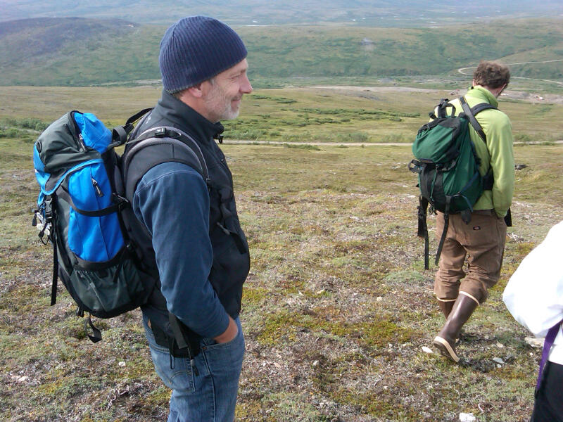
A quick checkout from our hotel and we were off to the airport. Larry and I had to shuttle people and luggage, but 30 minutes later everything was complete and we were ready to focus on a flight that would take us from the Seward Peninsula to the North Slope of Alaska.

Our trip from Nome to Barrow was chartered with Hageland Aviation Services. This was the same company we used last year and we were really happy with the experience. We were met at the gate by our pilot Jim and co-pilot Sterling. After a short safety briefing and check on the weather, we were escorted onto the tarmac and our Cessna Model 208B Caravan. The aircraft holds 11 and we filled every seat.


Larry and I had arranged for a flight that would take us from Nome back out towards Council. We wanted our team to see from the air what they saw yesterday on the ground. Because our team on this trip is composed mainly of modelers, there is a keen interest in having them see the different scales at which patterns and processes emerge across the landscape. Yesterday, we stood in thermokarst formations on the tundra, areas where permafrost is beginning to thaw and degrade. Today, our team is getting to see those same formations, but from a larger perspective. What they see are interconnected networks of features that snake their way across the tundra. These thermokarst features are representative of the dynamics we plan to measure and then include in advanced ecosystem and climate models in the coming years. One can easily envision how thawing of permafrost and subtle shifts in local-scale hydrology can drive important changes in vegetation dynamics, biogeochemistry, and then feedbacks to climate through influences on CO2 and CH4 exchange with the atmosphere.


After flying over Council, we headed north. One of the first things we noticed was the disappearance of trees, tall shrubs, and eventually even small shrubs were restricted to stream margins. The presence of patterned ground or ice-wedge polygons also became much more obvious. Again, these can be subtle features when on the ground, but they are very evident from the air. Haruko (from LBNL) has been quite diligent in taking notes and I saw that, while flying, she had sketched these polygons in her notebook. I am very impressed with how Haruko, and in fact a number of our team members, have committed themselves to learning as much as possible about Arctic ecosystems during this trip. Larry has been outstanding in his willingness to explain all he can to our team. He has a knack for translating complex topics into simple explanations and then layering on details as appropriate. Larry provides a great example of someone who is willing to transfer his knowledge to others and how that ability is such a benefit of the larger project.


After stopping for fuel in Kotzebue, we turned east towards Selewik. We visited this site last year and it was another tremendous visual of how dynamic the landscape can be in Alaska. This larger catastrophic thermokarst occurred several years ago in response to a disturbance along the Selewik River. This exposed permafrost to prevailing air temperatures and the area has been degrading ever since; expanding into the surrounding landscape. The pictures can be dramatic.


Our last stop of the day was an isolate runway at Ivotuk. We landed there after first crossing the Brooks Range. As expected, they were a rugged and remote range of mountains. Ivotuk is a site that Walt Oechel, San Diego State University, has maintained for many years. It is instrumented with a number of sensors and has capabilities for measuring greenhouse gas fluxes as well as other environmental variables like temperature, radiation, and wind speed.


You could not have asked for a better day to make this flight. The sun was out, but not the mosquitoes. We covered a lot of ground and compressed in time the transition of ecosystems from boreal forests to high Arctic tundra. Flying is such a great way to see all of this in a short period of time. It serves to reinforce the dynamic nature of these ecosystems along with the opportunities and challenges of what our team is committed to ding in the NGEE Arctic project. Along the way, we also managed to see a lot of caribou and one lone moose. Peter and a few others were lucky enough to spot 6 Grizzly bears; on each of two occasions there was a mother and 2 cubs. So it was deemed by all to be a successful day.


We landed in Barrow where Victoria and Alistair picked us up and handed off keys to the van and a truck. These will be handy as we shuttle people in and around town while touring our NGEE Arctic field sites and those associated with the Atmospheric Radiation Measurement (ARM) facility on the North Slope. That begins tomorrow; right now I'm anxious to get to our assigned housing and then to dinner. A soft bed, futon,  or couch would also be appreciated...cheers!

NGEE Arctic team makes its way to Council...

Everyone was ready bright and early this morning to make the 75 mile drive to Council. The road has been undergoing repairs, so we figured an early start would make up for any travel delays we might encounter. Fortunately, there were none and we arrived safely in the vicinity of Council by 10:30am. We did make several stops along the way. One especially nice one was in the foothill as we rose above the coastal plain and crested a pass. It was here that Larry introduced members of our modeling team to permafrost and the use of a long slender rod to determine thaw depth. Thaw depth is a function of air and soil temperature where ground frozen during the winter slowly thawing as air temperatures rise and the summer months progress. Although the ground at this location was admittedly rocky, we could still easily probe to determine active layer thickness. In most cases, it was only 35 to 40 cm; 12 to 15 inches maximum.


Later in the morning, we took the opportunity to dig a small hole in the tundra and examine it for organic matter, live roots, and mineral soil. It was a good illustration for our modelers as it showed carbon-rich soils in these permafrost environments.

We descended down the road onto the tundra that occurs in and around the Council area. Larry had worked in this area for many years and was familiar with the general landscape and how the area was dotted with a mix of short and tall shrubs, open woodlands, boreal forests, and then tundra. We spent the morning and into the afternoon looking at various features in the area including thermokarst, areas that form due in part to thawing permafrost. These are interesting features in that the tundra undergoes local subsidence, ponding of water, and then (with time) networks form and water moves laterally across the landscape. This process is poorly understood and not well, if at all, represented in models. We hope to add that level of understanding to models and it was, as a result, great to have the modelers on our team see these areas. There was a great deal of discussion and I believe that everyone came away with a much better appreciation for how dynamic these landscapes can be, especially in a climate that is characterized by warming temperatures.


Our lunch was enjoyed along Bear Creek just outside Council. It was a good opportunity to relax in what was surprisingly warm temperatures. We had a chance to talk about the morning activities and then highlight what was yet to come in the afternoon.


After lunch we had the opportunity to visit a near-by research site maintained by scientists from the Korean Polar Research Institute (KOPRI). They had a number of weather monitoring stations, eddy covariance towers for measuring greenhouse gas flux, and then small plastic chambers for measuring very local scale exchange of CO2 and CH4 between plants, soils, and the atmosphere. We had worked with one of these scientists earlier in the year and it was good to finally see their research site.


Although it proved to be a long day of driving and observing landscape dynamics on the tundra, our team had a very positive experience. To make a great trip better we came across sculpture or two outside remote cabins and an old dredge at least 60 miles from Nome. We saw several just like this one during our drive to and from Council. We also had the pleasure of seeing upwards to 100 muskox. They were all a little too far away for my camera but they were massive. I understand that populations of muskox in the Seward Peninsula were once low but are now making a come back. We took a late-day group picture with one herd in the background.


It was a demanding schedule, but nonetheless one that allowed us to see and do a lot of different things. Saturday we continue the learning experience as our team of modelers and Martin travel from Nome to Barrow. Should be an equally great day!


Friday, August 10, 2012

A perfect day on the Seward Peninsula

Our time in Anchorage was a good introduction to Alaska. We stocked up on needed supplies, organized our thoughts, and then it was off to Nome on the Seward Peninsula. The Alaska Airlines flight was less than two hours and we arrived just after noon. Still south of the Arctic Circle our team of 11 modelers, Martin, and BER managers saw the Horton Sound and Bering Sea out windows on one side of the airplane along with mixed tall and short shrub tundra out the windows on the other side of the airplane. It was a vivid introduction to the landscapes we were going to see in the next few days. Everyone exited the airplane with smiles and there seemed to be a lot of excitement for what awaited this group. Our journey had just begun, but I was hopeful that it was going to be a good day; a good week...


Larry Hinzman was at the airport to greet us, it was good to have him with us.  We loaded our luggage into the van for the short trip to the Aurora Inn and Suites. This Inn is a great place to stay and convenient to downtown, etc. After checking in, we picked up our second rental car and had a quick lunch at Airport Pizza. Interestingly, this restaurant is not anywhere close to the airport. Maybe all the other good names for a restaurant were already taken.


After lunch, which incidentally was pizza, it was then off to the grocery store for food and a few last minute items that would come in handy in the days to follow. We would be traveling to field research sites in Council, Alaska on Friday and we would need to be prepared. Food prices are high in Nome because lacking roads to the outside world, all food and everything else for that matter has to be transported in by air or sea. That carries with it a high price.

Once the necessities were taken care of, Larry organized a trip out to Anvil Mountain. This is a prominent feature to the northeast of Nome and was home to several weather monitoring stations the UAF staff had established over the years. It provided a reasonable first-day destination for our group and a chance to stretch our legs while orienting ourselves to the ecosystems that surround Nome. We spent the next three hours taking pictures, asking questions which Larry eagerly answered, and seeing the monitoring stations that dotted the landscape. People broke off into small groups to look at the vegetation, probe the soil, and generally get a sense for these complex landscapes. Martin was very comfortable in this environment, you could tell that he was at home in the outdoors.  I was pleased by how engaged he and others were in the many conversations that were taking place across the tundra. You could tell that people were really thinking about what they were seeing. There was diversity in everything we saw; meters, even centimeters, made a big difference.  As one looked across the valley, this diversity was obvious in larger scale patterns that played out across the slopes of the surrounding foothills.


Our afternoon ended as we hopped back in our vehicles for the short trip back to Nome. Tomorrow, we head off to Council and it looks to me like everyone is eager and ready for what lies ahead.

Thursday, August 9, 2012

Arrived safely in Anchorage, NGEE Arctic team prepares for Nome

Yesterday, groups of 2-4 people from around the country left their home institutions bound for Alaska. By late last night, our team was complete and everyone had arrived safely in Anchorage. In addition to Martin, Peter, Jitendra (or Jitu) and me; our foursome was joined by Charlie Koven and Haruko Wainwright from LBNL, Scott Painter and Chonggang Xu from LANL, and Mike Kuperberg, Gary Geernaert, and Sharlene Weatherwax from BER.


Although I have now made the trip to Alaska a dozen times in the last 18 months, the six hour flight from Chicago yesterday was long.  I was, however, able to double-check my notes to make sure that everything was in place for a good trip. Larry and I exchanged a few emails just as a precaution and to make sure our schedules were coordinated. Larry is in Nome now conducting research with a couple of his UAF colleagues, but has also been keeping a close eye on the weather, road conditions, and the size and number of mosquitoes. So far, so good, but Larry reminded me that Nome was a coastal village on the Horton Sound and Bering Sea and that everything could change in a minute. We reviewed Plan A and then made a few quick notes under the heading of Plan B. It is good to have Larry as a member of our team!

My travels to Alaska have taught me a valuable lesson.  Once you leave Anchorage and head north, your ability to purchase materials and supplies becomes increasingly limited. The exception to this is Fairbanks, but that would not be one of our destinations. So we took time to pick up a few last minute items...bought "Muck" boots for our treks across the tundra, tucked a few postcards into the backpack, and enjoyed the evening before heading out towards Nome and the Seward Peninsula Thursday morning.


Wednesday, August 8, 2012

Modelers and Martin head to Alaska

An old adage says that "every journey begins with a single step".  Today we took the first step in a seven day journey during which Peter Thornton, Jitendra Kumar, Martin Keller, and I will travel 330 miles north of the Arctic Circle. Our final destination is Barrow, Alaska on the Arctic Ocean; however, we will make intermediate stops throughout the week in Anchorage, Nome, Council, Kotzebue, Kougarak, Atqasuk, and Ivotuk as we travel from the Seward Peninsula to the North Slope of Alaska.


Our objective during this trip is to introduce modelers, Martin, and DOE managers to the science being conducted as part of the Next-Generation Ecosystem Experiments (NGEE Arctic) project. This project, led by ORNL, has the goal of delivering a process-rich model of Arctic ecosystems for inclusion into high-resolution Earth System Models. These models are used to simulate climate, both for the past and into the future, and the NGEE Arctic project is gathering data that will ultimately be used to form climate predictions.

This week our team from ORNL will be joined by eight others, including 4 modelers from Los Alamos National Laboratory and Lawrence Berkeley National Laboratory, three managers from the DOE, Office of Science, Biological and Environmental Research (BER) program, and the NGEE Arctic Chief Scientist, Larry Hinzman, from the University of Alaska Fairbanks. It has taken months to arrange this trip, as we will be visiting several remote locations where transportation, lodging, and logistical support take considerable planning.

Because the goal of the NGEE Arctic project is focused on integration of field and laboratory studies with computer models, taking modelers from our team to Alaska will give them a better idea of the systems they are attempting to simulate. This is an unusual step in that many modelers seldom get an up-close look at the fundamental properties and processes that need to be included in models. We are committed to changing that perspective this week. We took our field researchers on a similar trip last year, as we were planning for the NGEE Arctic project, and found that it was a valuable experience as we developed thoughts and ideas for what then was a pending proposal.

While this trip will reinforce project objectives for our team, it will also be an important learning experience for Martin and our sponsors at BER. Unlike previous studies conducted by our ORNL team, the NGEE Arctic project takes us a long way from where we have traditionally conducted our research. As such, it places a priority on managing the project safely and efficiently. Martin will be looking at how we can do that while conducting cutting-edge science in support of DOE missions at the same time. Our sponsors at BER have similar goals in that NGEE Arctic is the first of several research activities that they hope to launch in the coming years to improve representation of terrestrial ecosystems in climate models. They are keen to see not only how our team is performing early in the project, but to review other investments that they have made in Alaska, including the Atmospheric Radiation Measurement (ARM) program. The ARM program, also in Barrow, serves as a good example of how projects can be organized in remote areas, but still maintain high standards in data collection, QA/QC, and data accessibility. These elements are all important to the NGEE Arctic project as well.

We will join others involved in this trip later today in Anchorage. We will check into our hotels, buy a few last minute supplies, and then fly to Nome Thursday morning. Larry will meet us at the airport for a few days in Nome and surrounding areas before leaving for Barrow. We are looking forward to what will be a scientifically interesting and rewarding trip. Check back this week for daily blogs as our trip gets underway.

Monday, August 6, 2012

NGEE Arctic Synoptic Survey Team Rolls into Barrow - Cathy Wilson

The NGEE team continues its intensive summer field campaign in August with the arrival of the vegetation dynamics and hydrology teams. The Oak Ridge National Laboratory team of Rich Norby, Joanne Childs and Colleen Iversen joined Victoria Sloan, our NGEE Barrow Summer resident, for intensive leaf area and root inventories. I am joined by NGEE Barrow first timers: Jeff Heikoop, Brent Newman, Marvin Gard and Garrett Altman from Los Alamos National Laboratory to install biogeochemistry sampling test beds at our field plots, and to perform a synoptic survey of water chemistry from the polygon to regional scale.


Dave McGuire and Eugenie Euskirchen from University of Alaska, Fairbanks are here providing insight on the linkages between observations and modeling, and Barrow native Reynold “RJ” Aveogna is providing local knowledge about the BEO and surrounding environment while keeping watch for bears. RJ also has an uncanny ability to find equipment that the LANL team has lost. His tally so far includes my Blackberry and lens cap, and a handheld GPS. Thank you RJ!

The biogeochemistry test beds include a range of subsurface saturated and unsaturated water chemistry sampling technologies to determine the most effective way to obtain dynamic in-situ water chemistry samples from within the active layer. After two days of field work the LANL team has completed the installation of 13 drive point samplers for the synoptic survey and the saturated sampling components of two test beds.

We’re using the runoff pathway data that Anna Liljedahl and I collected during snowmelt in June to select sites for both the test beds and the synoptic survey. The hydrologic status on the BEO has gone through a dramatic transformation over the past 2 months, from highly inundated to relatively dry, except for the soggy troughs.

Plot D, situated in a drained thaw lake basin which was completely flooded in June is now saturated but with very little standing water.


The LANL team was joined by NGEE collaborators Adina Paytan and PhD student, Alanna Lecher, from University of California Santa Cruz on Thursday. They are collecting water chemistry samples with an emphasis on Radium and Radon to investigate shallow groundwater linkages between terrestrial systems, lakes, and oceans. Some of their sample sites overlap with NGEE plots and the regional scale synoptic water chemistry and isotope survey, and have the potential to provide highly synergistic hydrologic flow path data. The uppermost organic-rich portion of the active layer is very porous and transmissive, which enables Adina’s crew to pump 50 to 100 liters of soil water from a small soil pit through a filter to capture Radium and Radon in sufficient concentrations for their study.  Collaboration had an immediate practical outcome for NGEE when the LANL team borrowed one of Adina’s battery operated bilge pumps to clear fast flowing soil water out of an auger hole so we could install a piezometer more effectively. Thank you Adina!


Rich and the vegetation crew are also being very productive, though they look a little bleary-eyed from spending all day in the field and all night in the lab. The two teams met up for dinner last night at Northern Lights where we caught a glimpse of the Olympics coverage while discussing observations. Victoria was asked to do a interview at the local radio station, KBRW, but due to the tight vegetation team schedule, I filled in for the 7:30am program and provided an overview of the DOE SC TES project with an update of the many activities being undertaken by the National labs, UAF and our collaborators. I also did a “shout out” on the air to our wonderful UMIAQ logistic providers. I am now the proud owner of a KBRW coffee mug and pin.
 
So far the field conditions have been quite good, and we are grateful for wind, drizzle and a bit of cold weather since this is keeping the mosquitoes away. Wildlife sitting by the NGEE team include: humongous mosquitoes, a beluga whale, snowy owls and lemmings. We hope to see walrus and may get a chance if the ice blows into shore with a storm on Saturday. Lodging in the new Herman House location is very comfortable, and just a block from the grocery store. As with every visit to Barrow, the folks at UMIAQ are incredible!